SES & Flood Related Info
SES alerts are now published as part of Hazards Near Me – the replacement app for Fires Near Me. More info on our site here.
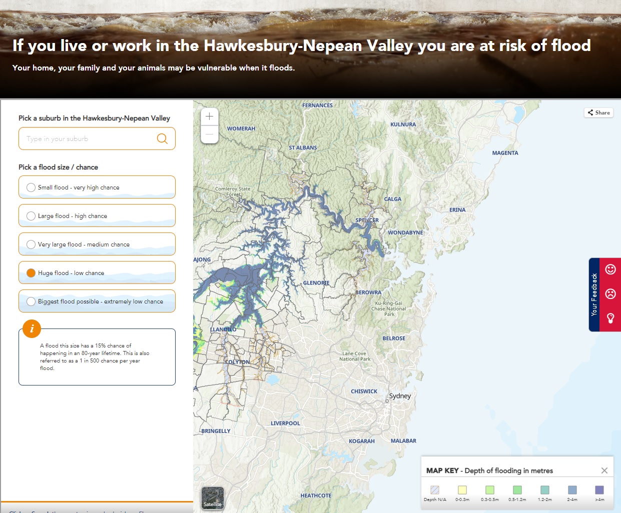
The SES publishes an amount of specific information on floods in the Hawkesbury-Nepean Valley on this link.
This includes an interactive map that shows likely flood levels at different event severities:
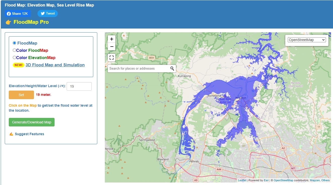
For other locations the Floodmap.net map also allows you to set the flood level and can be used anywhere in the world: